Randonnée Marche Le Hohwald - Le Hohwald Grande Bellevue Cascade de l'Andlau - Photo

Le Hohwald Grande Bellevue Cascade de l'Andlau

 oscar1
oscar1

Utilisateur

© OpenStreetMap contributors
Longueur
Longueur
10,4 km
Altitude max
Altitude max
856 m
Dénivelé positif
Dénivelé positif
335 m
Km-Effort
Km-Effort  
14,9 km
Altitude min
Altitude min
572 m
Dénivelé négatif
Dénivelé négatif
335 m
Boucle
Boucle
Oui
Date de création :
2022-10-17 09:24:25.958
Dernière modification :
2022-10-17 19:48:26.211

(0 Avis)

Marche
Marche
2h48
Difficulté : Facile

Scannez ce code QR pour ouvrir la randonnée dans l'application SityTrail

Application GPS de randonnée GRATUITE

Logo SityTrail SityTrail

IGN / Instituts géographiques

Télécharger SityTrail sur l'App Store Télécharger SityTrail sur Google Play

Logo SityTrail SityTrail World

Le monde est à vous

Télécharger SityTrail sur l'App Store Télécharger SityTrail sur Google Play Télécharger SityTrail sur Huawei AppGallery

À propos

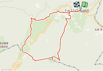
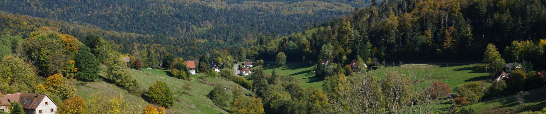
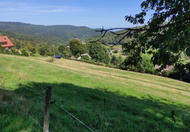
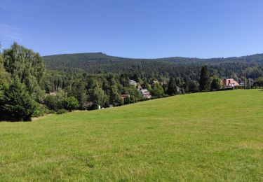
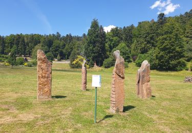
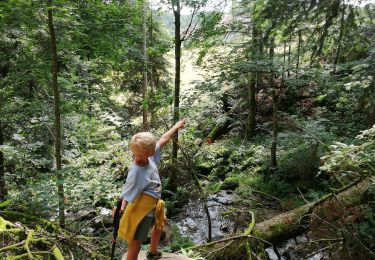
Randonnée Marche de 10,4 km à découvrir à Grand Est, Bas-Rhin, Le Hohwald. Cette randonnée est proposée par oscar1.

Description

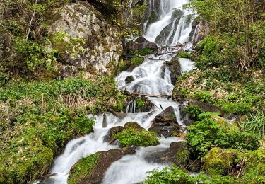
Vue sur le Haut Koenigsbourg depuis la Grande Bellevue. Belle cascade de l'Andlau

Profil altimétrique

Photos

Localisation

Pays :
France
Région :
Grand Est
Département/Province :
Bas-Rhin
Commune :
Le Hohwald
Localité :
Unknown
Départ:(UTM)
376343 ; 5362538 (32U) N.

Randonnées à proximité

Randonnée Marche Le Hohwald - 2024-04-27 Marche Cascade du Hohwald Champ du Feu - Photo
Marche
GUIDE
holtzv

Marche

Moyen
Le Hohwald, Grand Est, Bas-Rhin, France
20 km | 31 km-effort
6h 58min
Oui
Randonnée Marche Reichsfeld - 2019-12-28 Marche Reichsfeld Ungersberg Gruckert - Photo
Marche
GUIDE
holtzv

Marche

Très facile
Reichsfeld, Grand Est, Bas-Rhin, France
12,2 km | 20 km-effort
3h 5min
Oui
Randonnée Marche Le Hohwald - Tour du Hohwald - Photo
Marche
zazie

Marche

Moyen
(1)
Le Hohwald, Grand Est, Bas-Rhin, France
8 km | 11,3 km-effort
2h 26min
Oui
Randonnée Marche Ottrott - 2013-12-29 Marche Mt Ste Odile Maennelstein Birkenfels - Photo
Marche
GUIDE
holtzv

Marche

Moyen
(1)
Ottrott, Grand Est, Bas-Rhin, France
10,8 km | 15,4 km-effort
3h 24min
Oui
Randonnée Marche Le Hohwald - le hohwald, boucle
Marche
bemurix

Marche

Facile
Le Hohwald, Grand Est, Bas-Rhin, France
3,4 km | 4,8 km-effort
55min
Oui
Randonnée Marche Le Hohwald - Hohwald (ter) - Photo
Marche
ROPPJP

Marche

Difficile
Le Hohwald, Grand Est, Bas-Rhin, France
11,2 km | 15,6 km-effort
3h 31min
Oui
Randonnée Marche Le Hohwald - Le Hohwald (bis) - Photo
Marche
ROPPJP

Marche

Moyen
Le Hohwald, Grand Est, Bas-Rhin, France
7,9 km | 11,1 km-effort
2h 56min
Non
Randonnée Marche Le Hohwald - Par les sommets autour du Hohwald - Photo
Marche
VacheKiri67

Marche

Moyen
Le Hohwald, Grand Est, Bas-Rhin, France
15,1 km | 22 km-effort
4h 7min
Oui
Randonnée Marche Le Hohwald - cascade de Hohwald - Photo
Marche
apa

Marche

Très facile
Le Hohwald, Grand Est, Bas-Rhin, France
5,2 km | 7,2 km-effort
1h 2min
Non


Fermer
Mes abonnements